Aerial Image Labeling addresses a core topic in remote sensing: the automatic pixel-wise labelling of aerial imagery. The UNet leads to more advanced design in Aerial Image Segmentation. Future updates will gradually apply those methods to this repository.
I created the Github Repo used only one sample (kitsap11.tif ) from the public dataset (Inria Aerial Image Labelling ) to demonstrate the power of deep learning.
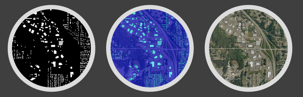
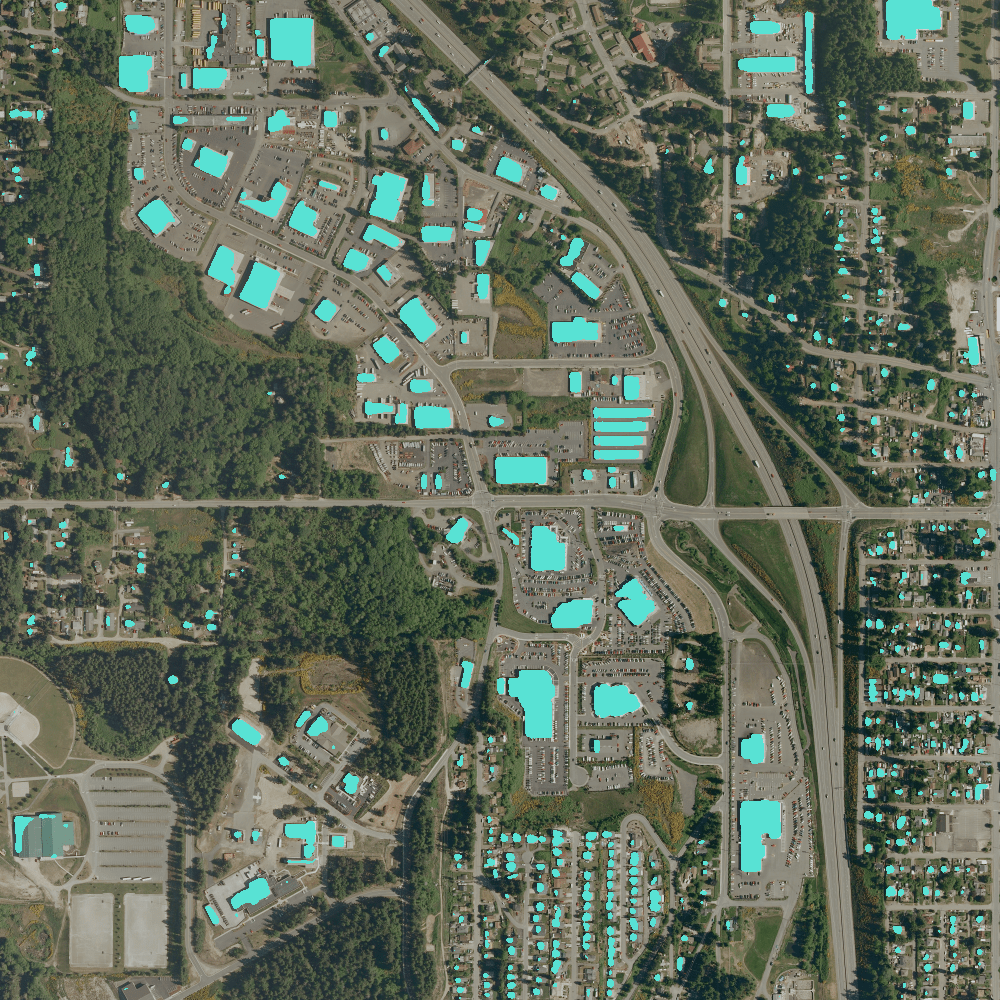
The original sample has been preprocessed into 1000×1000 with a 1.5-meter resolution. The following image shows the models prediction on the RGB images.
Programming details are updated on Github repos.
Dataset Features
The Inria Aerial Image Labeling addresses a core topic in remote sensing: the automatic pixel-wise labelling of aerial imagery (link to paper). Coverage of 810 km² (405 km² for training and 405 km² for testing) Aerial orthorectified colour imagery with a spatial resolution of 0.3 m Ground truth data for two semantic classes: building and not building (publicly disclosed only for the training subset) The images cover dissimilar urban settlements, ranging from densely populated areas (e.g., San Francisco’s financial district) to alpine towns (e.g,. Lienz in Austrian Tyrol).
Instead of splitting adjacent portions of the same images into the training and test subsets, different cities are included in each of the subsets. For example, images over Chicago are included in the training set (and not on the test set) and images over San Francisco are included on the test set (and not on the training set). The ultimate goal of this dataset is to assess the generalization power of the techniques: while Chicago imagery may be used for training, the system should label aerial images over other regions, with varying illumination conditions, urban landscape and time of the year.
The dataset was constructed by combining public domain imagery and public domain official building footprints.
Notification
The full data set is about 21 GB. In this repo, I select the following image as examples:
- RGB: AerialImageDataset/train/images/kitsap11.tif (75MB)
- GT: AerialImageDataset/train/gt/kitsap11.tif (812KB)
The original *.tif (GeoTIFF) image can be converted to a png image with the following code and the gdal package.
Reference
Github: https://github.com/cuicaihao/aerial-image-segmentation


Leave a comment